Minnesota
Minerals Coordinating Committee

GIS Catalog of Significant Minnesota Minerals and Geologic Datasets
The Minnesota DNR's Lands and Minerals Division, the Minnesota Geological Survey (MGS), and the Natural Resources Research Institute (NRRI) have an obligation to provide for the diversification of the State's mineral economy through long term support of mineral exploration, development, production, and commericialization" (Minn. State. sec. 93.001). One way to support this statute is by providing spatial information regarding Minnesota's ferrous, nonferrous, and industrial mineral resources. Provided on this page are weblinks to download significant Geographic Information Systems (GIS) datasets relevant to Minnesota's minerals resources that can be sorted by subject. This is not intended to be comprehensive list of all the spatial data related to Minnesota minerals and geology. For more information on additional sources, such as: historic mineral projects or research, mineral lease assessment files, geologic mapping, and more please see the additional information web page.
Click on the following for more information:
Base Maps
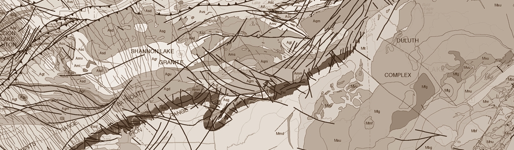
Bedrock Geology
Exploration Drilling
Geophysics
Geochemistry
Surficial Geology, Industrial Minerals, & Aggregate Resources
Mesabi Iron Range Geology
Soils Data
State Mineral and Peat Leasing
DNR Mineral Potential Project Boundaries
DNR Mineral Exploration Document Collections
Well Information (county well index)
By viewing or downloading any of the maps, reports, data, or other information provided on this website, you acknowledge that you have read and agree to the disclaimer at the bottom of this page.
Base Maps
| Date | Spatial Name | Theme | Subject | Agency | Link |
|---|---|---|---|---|---|
| 2015 | The Minnesota Geospatial Commons: The State of Minnesota's Geospatial Commons is the new repository for Minnesota spatial data (GIS). Users can download several GIS vector and raster datasets from many Minnesota governmental organizations and private organizations. The site includes links to extensive and summary level data descriptions (metadata) to support users. | Air Photos, Elevation data (LiDAR), Administrative Features, Climate, Control, Environmental Quality, Facilities, Geology and Soils, Hydrography, Land Cover, Land Imagery, Ownership, Public Land Survey, Scanned Maps, Transportation | BASEMAPS | Minnesota Geospatial Commons | Click for Web Site |
Bedrock Geology
| Date | Spatial Name | Theme | Subject | Agency | Link |
|---|---|---|---|---|---|
| 2011 | S-21 Geologic Map of Minnesota-Bedrock Geology. Download the maps and GIS data, view the layerfile in ArcGIS, or preview the map service. Layerfile and map service sourced from MGS's Online Map Services. | Bedrock Geology | Statewide (1:500,000) |
MGS | |
| 2011 | MGS Map Preview Service of County-Scale Bedrock Geology Raster Mosaic. Raster compilation of bedrock geology mapping in Minnesota. View as a layerfile in ArcGIS or preview the map service. Sourced from MGS's Online Map Services. | Bedrock Geology | Counties (1:100,000) |
MGS | |
| 2010 | MGS OFR-10-02 Preliminary Bedrock Geology Map of Minnesota. The contents of this report include preliminary geologic maps, bedrock topographic and depth to bedrock maps, and maps of ancillary data as pdf files, digital data files of the map elements, and those related to map compilation are also included. Please see S-21 for final bedrock geology map. | Bedrock Geology | Bedrock Topography / Outcrops | MGS | Maps & Data |
| 2010 | C-23 Geologic Atlas of Benton County, Minnesota [Part A]. Scales 1:100,00 and 1:200,000 |
Bedrock Geology | County Geologic Atlas | MGS | Maps & Data |
| 2010 | C-22 Geologic Atlas of Chisago County, Minnesota [Part A]. Scales 1:100,00 and 1:200,000 |
Bedrock Geology | County Geologic Atlas | MGS | Maps & Data |
| 2009 | C-19 Geologic Atlas of Carlton County, Minnesota [Part A]. Scales 1:100,00 and 1:200,000 |
Bedrock Geology | County Geologic Atlas | MGS | Maps & Data |
| 2007 | M-176 Bedrock Geology of the Bigfork 30 x 60 Minute Quadrangle, Northeast Minnesota. Scale 1:100,000 | Bedrock Geology | 30 X 60 Minute (1:100,000) | MGS | Maps & Data |
| 2007 | C-18 Geologic Atlas of Todd County, Minnesota [Part A]. Scales 1:100,00 and 1:200,000 |
Bedrock Geology | County Geologic Atlas | MGS | Maps & Data |
| 2006 | M-165 Bedrock Geology of the Deer Lake Complex, Itasca County, Minnesota. Scale 1:24,000 |
Bedrock Geology | Duluth Complex (1:24,000) | MGS | Maps & Data |
| 2004 | M-148 Bedrock Geology of the Ely and Basswood Lake 30 x 60 Minute Quadrangles, Northeast Minnesota. Scale 1:100,000 | Bedrock Geology | 30 X 60 Minute (1:100,000) | MGS | Maps & Data |
| 2004 | C-16 Geologic Atlas of Crow Wing County, Minnesota [Part A]. Scales 1:100,00 and 1:200,000 |
Bedrock Geology | County Geologic Atlas | MGS | Maps & Data |
| 2003 | M-141 Bedrock Geology of the Vermilion Lake 30 x 60 Minute Quadrangle, Northeastern Minnesota. Scale 1:100,000 | Bedrock Geology | 30 X 60 Minute (1:100,000) | MGS | Maps & Data |
| 2003 | C-15 Geologic Atlas of Pope County, Minnesota [Part A]. Scales 1:100,00 and 1:200,000 |
Bedrock Geology | County Geologic Atlas | MGS | Maps & Data |
| 2001 | M-114 Bedrock Geologic Map of the Eagles Nest Quadrangle, St. Louis County, Minnesota. Scale 1:24,000 |
Bedrock Geology | Duluth Complex (1:24,000) | MGS | Maps & Data |
| 2001 | M-119 Geologic Map of the Duluth Complex and Related Rocks, Northeastern Minnesota. Scales 1:200,000 and 1:500,000 |
Bedrock Geology | Duluth Complex (1:200,000)(1:500,000) |
MGS | Maps & Data |
| 2001 | C-13 Geologic Atlas of Pine County, Minnesota [Part A]. Scales 1:100,00 and 1:200,000 |
Bedrock Geology | County Geologic Atlas | MGS | Maps & Data |
| 2000 | S-20 Geologic Map of Minnesota, Bedrock Geology. Scale 1:1,000,000 |
Bedrock Geology | Statewide (1:1,000,000) |
MGS | Map & Data |
| 1999 | M-99 Bedrock Geology of the Aitkin 30 x 60 Minute Quadrangle, East-Central Minnesota. Scale 1:100,000 |
Bedrock Geology | 30 X 60 Minute (1:100,000) | MGS | Maps & Data |
| 1999 | M-100 Bedrock Geology of the Mille Lacs 30 x 60 Minute Quadrangle, East-Central Minnesota. Scale 1:100,000 | Bedrock Geology | 30 X 60 Minute (1:100,000) | MGS | Maps & Data |
| 1999 | M-092 Bedrock Geologic Map of Northwestern Minnesota. Scale 1:200,000 |
Bedrock Geology | Northwestern MN (1:200,000) | MGS | Maps & Data |
| 1999 | M-091 Bedrock Geologic Map of Allen Quadrangle, St. Louis County, Minnesota. Scale 1:24,000 |
Bedrock Geology | Duluth Complex (1:24,000) | MGS | Maps & Data |
| 1999 | M-101 Bedrock Geologic Map of the Central Duluth Complex and Western Part of the Beaver Bay Complex, Lake and St. Louis Counties, Minnesota. Scale 1:100,000 |
Bedrock Geology | Duluth Complex (1:100,000) |
MGS | Maps & Data |
| 1998 | M-085 Bedrock Geologic Map of the Virginia Horn, Mesabi Iron Range, St. Louis County, Minnesota. Scale 1:48,000 |
Bedrock Geology | Virginia Horn (1:48,000) | MGS | Maps & Data |
| 1998 | M-086 Bedrock Geologic Map of the Midway area (Virginia Horn), St. Louis County, Minnesota |
Bedrock Geology | Virginia Horn (1:12,000) | MGS | Maps & Data |
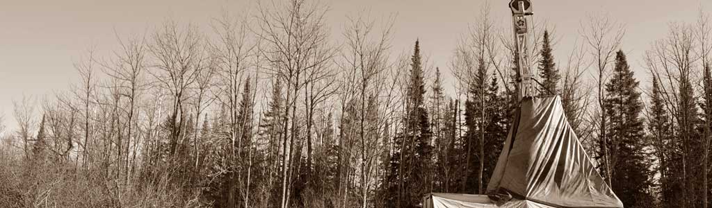
Exploration Drilling, Drill Core Evaluation, & Overburden Drilling
| Date | Spatial Name | Theme | Subject | Agency | Link |
|---|---|---|---|---|---|
| 2017 | Exploration and Engineering Drill Core Locations Stored at DNR's Drill Core Library in Hibbing, Minnesota |
Drilling Data | Drill Core Library | DNR | Data |
| 2016 | Bedrock Outcrop Samples Stored in the Drill Core Library
From the Minnesota Geological Survey (MGS) |
Outcrop Sample Data | Drill Core Library | DNR and MGS | Data |
| 2010 | Open-File Project 378 Koochiching County International Falls Greenstone Drill Core Assays |
Geologic Drilling | Examination & Assay | DNR | Map, Data, & Presentation |
| 2009 | NRRI Drill Log Files |
Geologic Drilling | Examination & Logs | NRRI | Data |
| 2008 | Open-File Project 373 St. Louis County Vermilion Greenstone Drill Core Assays |
Geologic Drilling | Examination & Assay | DNR | Data & Presentation |
| 1991 | DNR Report 280 Regional Survey of Buried Glacial Drift, Saprolite and Precambrian Bedrock in Lake of the Woods County, Minnesota. In January of 2014 the original digital data for this report was reformatted for GIS applications. | Geologic Drilling | Overburden Drilling | DNR | Maps, Data, & Reports |
| 1991 | DNR Report 278 Archean Drill Core Description and Assay in Lake of the Woods County, Minnesota; discussion and analysis of 45 drill cores. In January of 2014 the original digital data for this report was reformatted for GIS applications. |
Geologic Drilling | Examination & Assay | DNR | Data and Report |
| 1989 | DNR Report 264 1988-1989 Geodrilling Report; Hubbard, Becker, Koochiching, Beltrami & St. Louis counties. In January of 2014 the original digital data for this report was reformatted for GIS applications. |
Geologic Drilling | Examination & Assay | DNR | Data and Report |
| 1989 | DNR Report 263 A Regional Geochemical Survey of Glacial Drift Drill Samples Over Archean Terrane in the Effie Area, Northern Minnesota. In September of 2012 the original digital data for this report was reformatted for GIS applications. | Geologic Drilling | Overburden Drilling | DNR | Maps, Data, & Reports |
| 1989 | DNR Report 255-1/265/266 1988-1989 Drill Core Repository Sampling Project: 255-1 Duluth Complex, 265 Soudan Mine, 266 Archean Greenstone; analysis of drill core from Duluth complex, Soudan mine, & greenstone terranes. In January of 2014 the original digital data for this report was reformatted for GIS applications. |
Geologic Drilling | Examination & Assay | DNR | Data and Report |
| 1988 | DNR Report 252 Regional Survey of Buried Glacial Drift Geochemistry Over Archean Terrane in Northern Minnesota. In June of 2012 the original digital data for this report was reformatted for GIS applications. | Geologic Drilling | Overburden Drilling | DNR | Maps, Data, & Reports |
| 1987 | DNR Report 251 1985-1986 Geodrilling Report; DNR Drill Core from T46N R25W, T46N R28W, T52N R15W, T59N R12W, T56N R14W, T57N R12W In March of 2014 the original digital data for this report was reformatted for GIS applications. It was published in April of 2015. |
Geologic Drilling | Examination & Assay | DNR | Data and Report |
| 1985 | DNR Report 242 1984-1985 Geodrilling Report; DNR Drill Core from T70N-71N R23W, T52N R15W, T55N R13W, T56N R18W, T57N R13W, T57N R11W, T59N R9W, T60N R10W-11W In March of 2014 the original digital data for this report was reformatted for GIS applications. It was published in April of 2015. |
Geologic Drilling | Examination & Assay | DNR | Maps, Data, and Report |
Geophysics
| Date | Spatial Name | Theme | Subject | Agency | Link |
|---|---|---|---|---|---|
| 2017 | DNR Open-File Project 401 - Aeromagnetic Data Reprocessing Test | Geophysics | Aeromagnetic: Statewide | DNR | Report & Data |
| 2011 | MGS B38813 Upgrade of the Gravity Database. Compilation of Gravity Stations in Minnesota with new and revised locations. Dowload Report and Data, ArcGIS Layerfile, or Map Preview Service are available. Sourced from MGS's Online Map Services. | Geophysics | Gravity Data | MGS | Report and Data / Layerfile / Preview Service |
| 2011 | MGS B37919 Density, Magnetic Susceptibility, and Natural Remanent Magnetication of Rocks In Minnesota: An MGS Rock Properties Database. Download Report and Data, ArcGIS Layerfile, or Map Preview Sercice are available. Sourced from MGS's Online Map Services. | Geophysics | Rock Properties Database | MGS | Report and Data / Layerfile / Preview Service |
| 2007 | MGS Revised Aeromagnetic Data for Minnesota | Geophysics | Aeromagnetic: Statewide | MGS | Maps & Data |
Geochemistry
| Date | Spatial Name | Theme | Subject | Agency | Link |
|---|---|---|---|---|---|
| 2005-2017 | GIS Data for DNR's Gold in Till Geochemistry Surveys |
Metallic Minerals | Geochemistry | DNR | Data |
| 2013 | Open File Project 392 Regional Survey of Gold in Till, Cook Area, St. Louis County, Minnesota. | Geochemistry | Gold in Till | DNR | Map & Data |
| 1997 | DNR Report 318 Mineral Potential Study, Greenstone Belt Boulder Tracing in the Ely Bigfork Area. In January of 2014 the original digital data for this report was reformatted for GIS applications. | Geochemistry | Glacial Drift | DNR | Data & Reports |
| 1992 | DNR Report 284 Regional Survey of Buried Glacial Drift, Saprolite and Precambrian Bedrock in Lake of the Woods County, Minnesota. In January of 2014 the original digital data for this report was reformatted for GIS applications. | Geochemistry | Glacial Drift | DNR | Data & Reports |
| 1986 | DNR Report 246 Esker Prospecting Over the Duluth Complex in Northeastern Minnesota; stream sediment exploration techniques for Pt-Pd, Au-Ag, Ti, Cr, Cu & Ni. In January of 2014 the original digital data for this report was reformatted for GIS applications. | Geochemistry | Glacial Drift | DNR | Maps, Data, & Reports |
| 2011 | Open File Project 385 Geochemical Survey on Public Lands in the International Falls Area, Koochiching County, Minnesota. | Geochemistry | Gold in Till | DNR | Maps, Data, & Reports |
| 2010 | Open File Project 379 Regional Survey of Gold in Till, Archean Greenstone Belt, Northeastern Itasca County |
Geochemistry | Gold in Till | DNR | Map, Data, and Presentation |
| 2009 | Open File Report OFR-09-02 Minnesota Soil, Till, and Ground-Water Geochemical Data. |
Geochemistry | Soil, Till, & Water | MGS | Report, Maps, & Data |
| 2009 | Report 376 Minnesota Lake Sediment Geochemistry Surveys; Report 73 pages; Appendix A 4 pages; GIS Datasets-MN DNR Collection & U.S. Steel Collection. |
Geochemistry | Lake Sediment Compilation | DNR | Report & Data |
| 2005 | Report 365 Glacial Till Sampling in the Vermilion Greenstone Belt, Northeastern Minnesota; 85 pages; GIS data, tables, figures, and appendices. |
Geochemistry | Gold in Till | DNR | Report and Data |
| 1994 | Report 308 Platinum, Palladium and Gold Distribution in B-Horizon Soils in the Northwestern Part of the Duluth Complex, Minnesota; A cooperative project with the United States Geological Survey; 15 pages. |
Geochemistry | Soil | DNR | Report and Data |
| 1994 | Report 296 Soil Geochemistry Survey (B-Horizon) in Linden Grove Area |
Geochemistry | Soil | DNR | Report and Data |
| 1989 | Report 262 1989 Glacial Drift Geochemistry for Strategic Minerals; T59N-61N R7W-11W; references, element contour maps; 275 pages (two volumes), 3 plates. Tabular data converted to GIS data in 2010 |
Geochemistry | Glacial Drift | DNR | Report, Maps, & Data |
| Varied | USGS National Geochemical Database: Rock (Data for Minnesota in the Nationwide Dataset); Geochemical analysis of rock samples collected and analyzed by the USGS. This dataset includes and supersedes rock data formerly released as "Geochemistry of igneous rocks in the US extracted from the PLUTO database". The database contains 414,304 records. |
Geochemistry | Rock Samples | USGS | Data |
| Varied | USGS National Geochemical Survey Database (Data for Minnesota in the Nationwide Dataset); National-scale geochemical analysis of stream sediments and soils in the US, from existing data, reanalysis of existing samples, and new sampling. Goal for sample density is one per 289 square km. | Geochemistry | Stream and Soil Samples | USGS | Data |
Surficial Geology, Industrial Minerals, & Aggregate Resources
| Date | Spatial Name | Theme | Subject | Agency | Link |
|---|---|---|---|---|---|
| 2015 | Compilation of Aggregate Resource Mapping Program GIS Data |
Industrial Minerals | Aggregate Mapping | DNR | Data |
| 2014 | Report 381 Sand and Gravel Resources of Aitkin County, MN |
Industrial Minerals | Aggregate Mapping | DNR | Maps & Data |
| 2012 | Report 362 Aggregate Resources of Stearns County, MN: Sand and Gravel Potential and Crushed Stone Potential |
Industrial Minerals | Aggregate Mapping | DNR | Maps & Data |
| 2011 | Report 384 Aggregate Resources of Kanabec County, MN: Sand and Gravel Potential |
Industrial Minerals | Aggregate Mapping | DNR | Maps & Data |
| 2011 | Raster compilation of surficial geology mapping in Minnesota at 1:100,000 scale. View in ArcGIS by Clicking on the Layerfile or use the MGS's Map Preview Service. Sourced from the MGS's Online Map Services. |
Surficial Geology | County Level Surficial Geology at 1:100,000 | MGS | Layerfile / Preview Service |
| 2011 | Report 380 Aggregate Resources and Silt and Clay Potential in Northern St. Louis and Lake Counties, Minnesota |
Industrial Minerals | Aggregate Mapping | DNR | Maps, Data, & Reports |
| 2010 | C-23 Geologic Atlas of Benton County, Minnesota [Part A]. Scales 1:100,00 and 1:200,000 |
Surficial Geology | County Geologic Atlas | MGS | Maps & Data |
| 2010 | C-22 Geologic Atlas of Chisago County, Minnesota [Part A]. Scales 1:100,00 and 1:200,000 |
Surficial Geology | County Geologic Atlas | MGS | Maps & Data |
| 2009 | Report 374 Aggregate Resources of Carlton County, Minnesota and Fond du Lac Reservation, Minnesota |
Industrial Minerals | Aggregate Mapping | DNR | Maps & Data |
| 2009 | Report 375 Aggregate Resources of Olmsted County, Minnesota; Sand and Gravel Potential & Crushed Stone Potential; 2 plates. | Industrial Minerals | Aggregate | DNR | Maps & Data |
| 2008 | Report 365 Aggregate Resources of Mille Lacs County, Minnesota |
Industrial Minerals | Aggregate Mapping | DNR | Maps & Data |
| 2007 | C-18 Geologic Atlas of Todd County, Minnesota [Part A]. Scales 1:100,00 and 1:200,000 |
Surficial Geology | County Geologic Atlas | MGS | Maps & Data |
| 2006 | Report 364 Aggregate Resources and Surficial Geology of Meeker County, Minnesota | Industrial Minerals | Aggregate Mapping & Surficial Geology | DNR | Maps & Data |
| 2005 | M-131 Aggregate Resource Potential of Itasca County, Minnesota | Industrial Minerals | Aggregate Mapping & Surficial Geology | MGS | Maps & Data |
| 2004 | NRRI/TR-2004/29 Regional and Local Geologic and Geochemical Controls on Industrial Clay Grades Between Granite Falls and Redwood Falls, Minnesota |
Industrial Minerals | Clays Kaolin | NRRI | Report & Data |
| 2004 | C-16 Geologic Atlas of Crow Wing County, Minnesota [Part A]. Scales 1:100,00 and 1:200,000 |
Surficial Geology | County Geologic Atlas | MGS | Maps & Data |
| 2003 | C-15 Geologic Atlas of Pope County, Minnesota [Part A]. Scales 1:100,00 and 1:200,000 |
Surficial Geology | County Geologic Atlas | MGS | Maps & Data |
| 2003 | Report 363 Aggregate Resources and Surficial Geology of Renville County, Minnesota |
Industrial Minerals | Aggregate Mapping & Surficial Geology | DNR | Maps & Data |
| 2003 | Report 360 Aggregate Resources and Surficial Geology, LeSueur County, Minnesota; 2 plates. |
Industrial Minerals | Aggregate & Surficial Geology | DNR | Maps & Data |
| 2003 | Report 358 Inventory of Publicly Owned Stockpiles and Natural Aggregate Resources at the Former LTV Mine and Vicinity; report 20 pages; two plates; GIS datasets; photos; database; and spreadsheets. | Industrial Minerals | Aggregate & Stockpiles | DNR | Report, Maps, and Data |
| 2002 | Report 340 Minnesota River Valley Mineral Resources; Compilation of Mineral Resources Digital Information for the Minnesota River Valley Corridor | Industrial Minerals | Mineral Resources Compilation | DNR, MGS, & NRRI | Maps & Data |
| 2002 | Report 356 Aggregate Resources and Surficial Geology of Benton County, Minnesota |
Industrial Minerals | Aggregate Resource Mapping & Surficial Geology | DNR | Maps & Data |
| 2002 | Report 357 Aggregate Resources and Surficial Geology of Dodge County, Minnesota |
Industrial Minerals | Aggregate Mapping & Surficial Geology | DNR | Maps & Data |
| 2001 | M-116 Aggregate Resource Potential of Chisago County, Minnesota | Industrial Minerals | Aggregate Mapping & Surficial Geology | MGS | Maps & Data |
| 2001 | C-13 Geologic Atlas of Pine County, Minnesota [Part A]. Scales 1:100,00 and 1:200,000 |
Surficial Geology | County Geologic Atlas | MGS | Maps & Data |
| 2001 | Report 352 Aggregate Resources of Sherburne County, Minnesota. Digital data based on maps completed in July of 1987 and digitized in 2000. 2 plates. |
Industrial Minerals | Aggregate Mapping | DNR | Maps & Data |
| 2001 | Report 350 Stockpile Ownership, Composition, and Use for Two Study Areas Located near Virginia and Calumet, Minnesota; 79 pages; 4 plates; 1 map; chemical asssay data. | Industrial Minerals | Stockpiles | DNR | Report, Maps, and Data |
| 2000 | Report 343 Aggregate Resources and Surficial Geology of Nicollet County, Minnesota |
Industrial Minerals | Aggregate Mapping & Surficial Geology | DNR | Maps & Data |
| 1999 | Report 335 Aggregate Resources and Surficial geology of Blue Earth County, Minnesota |
Industrial Minerals | Aggregate Mapping & Surficial Geology | DNR | Maps & Data |
| 1999 | M-102 Primary Sources of Construction Aggregate in the Twin Cities Seven-County Metropolitan Area, Minnesota | Industrial Minerals | Aggregate Mapping | MGS | Maps & Data |
| 1997 | Geomorphology of Minnesota 1:100,000 Scale Geomorphology Data Describing a Wide Variety of Conditions Related to Surficial Geology Within a Hierarchical Classification Scheme that was Devised for Use within Minnesota. |
Surficial Geology | Statewide (1:100,000) | DNR, UMD, MGS | Data & Metadata |
| 1997 | Report 306 Aggregate Resources, Eastern Clay County, Minnesota; 4 plates. |
Industrial Minerals | Aggregate & Surficial Geology | DNR | Maps & Data |
| 1993 | Report 289/298/298-2 Dimension Stone Inventory of Northern Minnesota |
Industrial Minerals | Dimension Stone | DNR | Report & Data |
| 1992 | Report 304 Aggregate Resources and Quaternary Geology of Isanti County, Minnesota |
Industrial Minerals | Aggregate Mapping | DNR | Maps & Data |
| 1991 | Report 294 Aggregate Resources and Quaternary geology of Wright County, Minnesota | Industrial Minerals | Aggregate Mapping & Surficial Geology | DNR | Maps, Data, & Report |
| 1982 | S-01 Geologic Map of Minnesota, Quaternary Geology. Scale 1:500,000 |
Surficial Geology | Statewide (1:500,000) |
MGS | Map & Data |
Mesabi Iron Range Geology
| Date | Spatial Name | Theme | Subject | Agency | Link |
|---|---|---|---|---|---|
| 2005 | M-163 Bedrock Geology of the Mesabi Iron Range, Minnesota. Scale 1:100,000 |
Bedrock Geology | Iron Range (1:100,000) |
MGS | Maps & Data |
| 2005 | M-164 Surficial Geology of the Mesabi Iron Range, Minnesota | Surficial Geology | Iron Range (1:100,000) |
MGS | Maps & Data |
| 2005 | M-158 Bedrock Geology Database, Bedrock Topography, and Depth to Bedrock Maps of the Eastern Half of the Mesabi Iron Range, Northern Minnesota. Scale 1:100,000 |
Bedrock Geology | Iron Range (1:100,000) |
MGS | Maps & Data |
| 2002 | M-126 Bedrock Topographic and Depth to Bedrock Maps of the Western Half of the Mesabi Iron Range, Northern Minnesota. Scale 1:100,000 |
Bedrock Geology | Iron Range (1:100,000) |
MGS | Maps & Data |
Soils Data
| Date | Spatial Name | Theme | Subject | Agency | Link |
|---|---|---|---|---|---|
| 2014 | SSURGO Data Downloader: ArcGIS Web Map Application to Access and Dowload SSURGO Soil Data |
Soils | NRCS Soil Survey - SSURGO | NRCS | Web Map Application and Data |
State Minerals Leasing and State Peat Leasing
| Date | Spatial Name | Theme | Subject | Agency | Link |
|---|---|---|---|---|---|
| Current | The State of Minnesota issues mineral leases on state-owned and state-administered fee mineral interests. The lease types include iron ore, taconite, industrial mineral, non-ferrous, and miscellaneous. These layers are of active or historic State mineral leases, administered by the Minnesota Department of Natural Resources, mapped to the PLS forty and government lot. |
State Mineral Leasing | Active and Historic State Mineral Leases | DNR | Data |
| 2016 | Areas Ever Offered for State Metallic Mineral Leases (May 26, 2016) are areas of the State that have been offered for non-ferrous, metallic mineral lease sale, mapped to the PLS forty/government lot. Areas to offer are initially identified to the section level. Subsequent research and review is done to identify the specific areas that will be offered for lease. |
State Mineral Leasing | State Mineral Leases Ever Offered | DNR | Data |
| 2011 | State Mineral Management Corridor also called the Boundary Waters Canoe Area Wilderness (BWCAW) Mineral Management Corridor Boundary. The MN DNR has established procedures whereby certain state lands in the proximity to the BWCAW are not offered for mineral leasing. |
State Mineral Leasing | Mineral Management Corridor | DNR | Data |
| Current | The State of Minnesota issues peat leases on state-owned and state-administered fee surface interests. These layers are of active or historic State peat leases, administered by the Minnesota Department of Natural Resources, mapped to the PLS forty and government lot. |
State Peat Leasing | Active and Historic State Peat Leases | DNR | Data |
DNR Mineral Potential Project Boundaries
| Date | Spatial Name | Theme | Subject | Agency | Link |
|---|---|---|---|---|---|
| 2016 | DNR Mineral Potential Projects Boundaries: GIS shapfile showing boundaries of DNR published and open-file mineral projects since 1976. The shapefile's attributes include a URL to hyperlink to the DNR project webpages to download digital data where available. |
DNR Mineral Potential Projects Boundaries | Index of Projects | DNR | Data |
DNR Mineral Exploration Collections: Minnesota Mineral Resources Database
| Date | Spatial Name | Theme | Subject | Agency | Link |
|---|---|---|---|---|---|
| 2024 | The Minnesota Department of Natural Resources maintains and shares scientific and economic information from mineral exploration projects. The MMRD offers search and retrieval of historical and contemporary documents including exploration reports, economic analyses, geophysical maps, geospatial data, drill logs, and assays. Web map and library search interfaces are offered. |
DNR Mineral Exploration Collections | MMRD | DNR | Web Site |
Well Information (County Well Index)
| Date | Spatial Name | Theme | Subject | Agency | Link |
|---|---|---|---|---|---|
| 2015 | Minnesota County Well Index Web Application, County Well Index (CWI) Online is a web-based version of the CWI data system developed by the Minnesota Geological Survey (MGS) and the Minnesota Department of Health (MDH) for the storage, retrieval, and editing of water-well information. The CWI database contains basic information, such as location, depth, and static water level, for wells drilled in Minnesota. The database contains construction and geological information from the well record (well log) for many wells. CWI Online also provides mapping of wells onto aerial photos, allowing users to visually identify well locations. |
Drilling Data | Water Wells & Other Borings | MGS, DOH | Web App |
Disclaimer and Copyright Protection: Maps, Reports, Data, and Other Information
The State of Minnesota makes no representations or warranties express or implied, with respect to the use of the information contained herein regardless of its format or the means of its transmission. There is no guarantee or representation to the user as to the accuracy, currency, suitability, completeness, usefulness, or reliability of this information for any purpose. The user accepts the information "as is." The State of Minnesota assumes no responsibility for loss or damage incurred as a result of any user's reliance on this information. All maps, reports, data, and other information contained herein are protected by copyright. Permission is granted to copy and use the materials herein for any lawful noncommercial purpose. Any user of this information agrees not to transmit or provide access to all or any part of this information to another party unless the user shall include with the information a copy of this disclaimer.